See all your GPX routes on one map.
Pedaltales draws every GPX file you drop in on one interactive map — a finished trip next to its route variants, this year's rides next to last year's. No file-at-a-time viewing, and nothing to install.
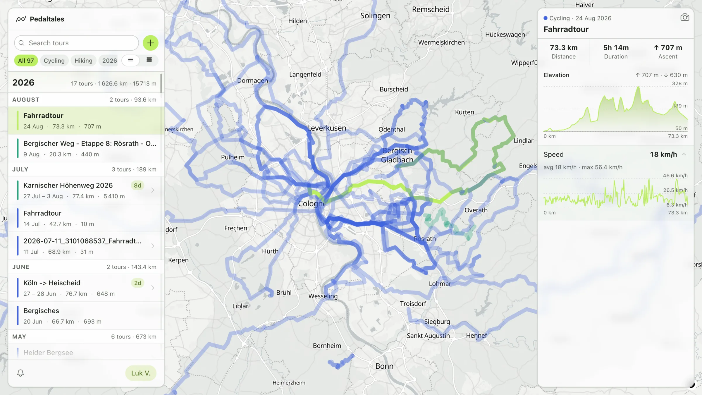
As many files as you like
Drag in one GPX or a whole folder of them. Every route is drawn on the same interactive map, and clicking a line opens it: distance, climb, dates, and the elevation profile.The map remembers
Most GPX viewers show a file and forget it. Here every file you add stays — your routes build up into an atlas of everywhere you've been, waiting next time you come back.Trips combine, variants stay apart
Combine the day files of one trip into a single tour, or keep route variants side by side to compare. Cycling, hiking, running, skiing — each tour keeps its activity type.Your routes deserve better than downloads.
Still need the files? The export guides get your GPX out of Strava, Komoot, and Garmin Connect in under a minute each. And once they're in, you can save a map of all your rides as an image.
Do I need an account?
A sign-in, not a setup: enter your email and click the link we send — no password, no credit card. The sign-in is what lets your map persist instead of vanishing when the tab closes, and you can delete everything, anytime.
Which files work?
GPX files from anywhere — Strava, Komoot, Garmin, a bike computer, a watch. Tracks you recorded and routes you planned both draw fine.
What does it cost?
Nothing. Pedaltales is a passion project, free to use, with no ads and no selling of your data.